Understanding California’s Groundwater
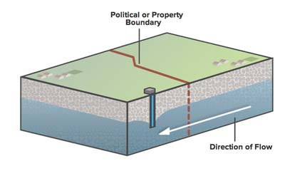
Contrary to a popular misconception of an underground river or lake, groundwater is found in the tiny spaces between sand and gravel and rock.
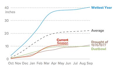
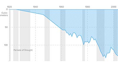
Before a wet February, the 2013-14 water year in California was on its way to being the driest on record.
Groundwater levels have dropped 50 feet below historical lows, with levels in many areas in the San Joaquin Valley more than 100 feet below previous historical lows
Central Valley aquifers lost 140 cubic kilometers of freshwater – an amount roughly four and a half times the capacity of Lake Mead in Nevada, the nation’s largest reservoir.
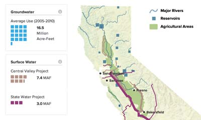
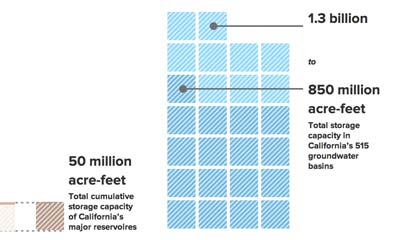
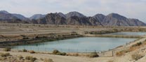
Aqueducts and reservoirs distribute surface water from the mountains through the Sacramento-San Joaquin Delta, and on to the Central Valley and points far south.
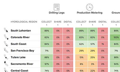
Total scores on groundwater data collection and sharing across the state as a whole were low, with 9 of the 10 hydrologic regions scoring less than 5 out of a possible 10 points. The South Lahontan hydrologic region scored the highest with 6 points.
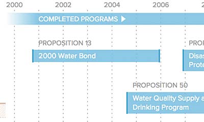
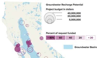
Water in the West researchers obtained all available grant applications submitted to DWR for the four recharge-related grant programs listed above. This new study evaluated 136 grant applications filed over the past 14 years
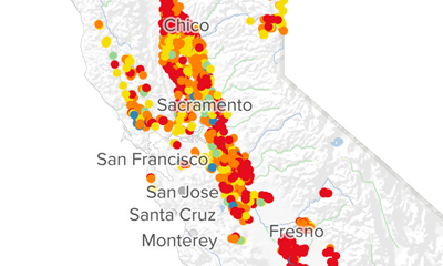
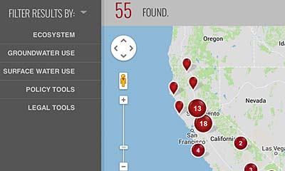
Based on our dataset of 55 conflicts drawn from publicly available information collected from 2008-2012, the map shows where these conflicts occur, what the problems are, and how they are dealt with.