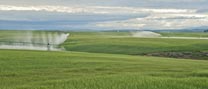
Groundwater Data Collection and Sharing Scores by Hydrologic Region
Drilling Logs
Production Metering
Groundwater Elevation
Model
Total
Score
| Hydrological Region | Collect 1 |
Share 1 |
Digital 1 |
Collect 1 |
Share 1 |
Digital 1 |
Collect 1 |
Share 1 |
Digital 1 |
Develop 1 |
Overall Max: 10 |
||||
|---|---|---|---|---|---|---|---|---|---|---|---|---|---|---|---|
| South Lahontan | 89% | 0% | 0% | 89% | 89% | 0% | 89% | 83% | 78% | 89% | 6.0 | ||||
| Colorado River | 83% | 0% | 0% | 83% | 83% | 0% | 100% | 58% | 0% | 50% | 4.6 | ||||
| South Coast | 84% | 0% | 0% | 62% | 57% | 1% | 84% | 54% | 34% | 50% | 4.3 | ||||
| San Francisco Bay | 71% | 0% | 0% | 29% | 29% | 0% | 71% | 64% | 29% | 71% | 3.6 | ||||
| Tulare Lake | 88% | 0% | 0% | 13% | 25% | 0% | 88% | 56% | 31% | 50% | 3.5 | ||||
| Sacramento River | 97% | 0% | 0% | 6% | 3% | 0% | 94% | 70% | 39% | 24% | 3.3 | ||||
| Central Coast | 74% | 0% | 0% | 15% | 22% | 0% | 74% | 54% | 20% | 33% | 2.9 | ||||
| North Lahontan | 100% | 0% | 0% | 0% | 0% | 0% | 100% | 57% | 0% | 14% | 2.7 | ||||
| San Joaquin River | 78% | 0% | 0% | 6% | 0% | 0% | 78% | 17% | 22% | 33% | 2.4 | ||||
| North Coast | 33% | 6% | 0% | 0% | 11% | 0% | 33% | 28% | 17% | 33% | 1.6 |